On March 23, 2014, a large landslide wiped out a small community in Snohomish County, Washington. A spokesman for the Snohomish County Department of Emergency Management is quoted as saying, “This was a completely unforeseen slide. This came out of nowhere.” But it was predicted decades ago (see Yakima Herald). And, as we shall see, this area has had many slides. Ignore geology at your peril. From what I can surmise, the people who lived there were never informed of the hazard.
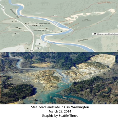
The top panel of the first figure shows the layout of the community along the Stillaguamish River and the uplands. The bottom panel is an aerial photo of the slide.
The area along the river consists of unconsolidated glacial debris (composed of rock, sand, and mud) deposited during the last glacial epoch. Heavy rains during the first weeks of March weakened this material which was holding up material higher on a cliff until it finally let go. This is the usual scenario for landslides, the toe, holding up the material, is weakened by some force.
The March 23 landslide was not the first in the area.
Past landslide events or reports about this area:
1949: A large landslide (1000 feet long and 2600 feet wide) affected the river bank.
1951: Another large failure of the slope; the river was partially blocked.
1967: Seattle Times published an article that referred to this site as “Slide Hill.”
1997 report, by Daniel Miller, for the Washington Department of Ecology and the Tualialip Tribes.
1999: US Army Corps of Engineers report by Daniel and Lynne Rodgers Miller that warned of “the potential for a large catastrophic failure.”
25 January 2006: large movement of the Steelhead landslide blocked the river.
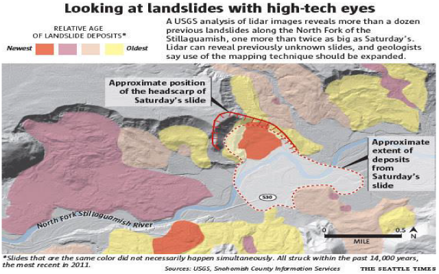
The next graphic shows an interpretation from the U.S. Geological Survey, compiled by the Seattle Times. Notice that one of the slides is twice as big as the March 23 slide.
For more commentary, photos, and links to other coverage, see Wayne Ranney’s blog: Earthly Musings.
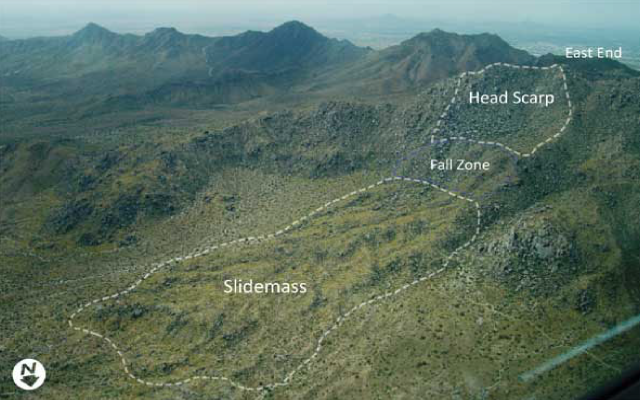
Landslides like this have occurred in Arizona, although a long time ago. For instance, the Marcus Landslide in the McDowell Mountains (500,000 years ago) contained 5.5 million cubic meters of granite rock, vegetation and soil, and covered an area of 1,650 feet by 4,000 feet and 100 feet deep. Its footprint is very much like the Washington landslide. (For more information see: http://www.azgs.az.gov/MarcusLandslide_2008.shtml )
For more information on geologic risk in Arizona, see the Homeowners Guide to Geologic Hazards in Arizona.
For more geology stories see:
A Brief Geologic History of Arizona Chapter 1 Precambrian
A Brief Geologic History of Arizona Chapter 2 Cambrian and Ordovician time
A Brief Geologic History of Arizona Chapter 3 Silurian to Permian
Arizona Geological History Chapter 4: Triassic Period
A brief geologic history of Arizona Chapter 5: Jurassic Time
A brief geologic history of Arizona Chapter 6: Cretaceous Time
A brief geologic history of Arizona Chapter 7, the Cenozoic Era